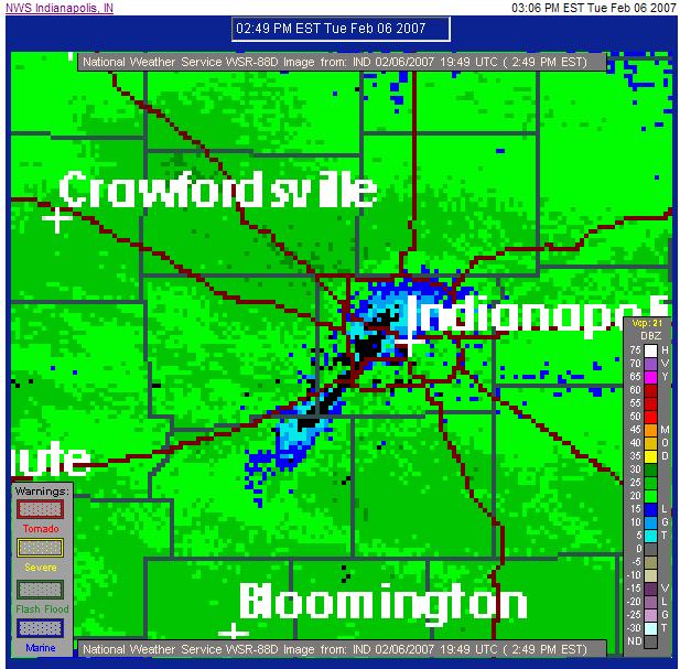
I was just looking at the NWS radar loop for Indianapolis and noticed something strange.
Click for larger image
See the blue-bordered black strip running from just northeast of downtown Indy down through northeast Morgan County?
That’s the air traffic pattern in and out of Indianapolis International Airport. The planes are affecting the snowfall pattern over that area. The black line is the area where the planes are blowing the snow completely out of their path. The blue border around the black no-snow area is an area of less precipitation than the green all around it. This is really easy to see in the loop itself, because it doesn’t move at all. (Note: That link won’t show this in another hour or so, because the storm is moving through very quickly.)
How cool…

A "surly curmudgeon[], suspicious and lacking in altruism." (Robert A. Heinlein)